Boosting Remote Sensing with Machine Learning
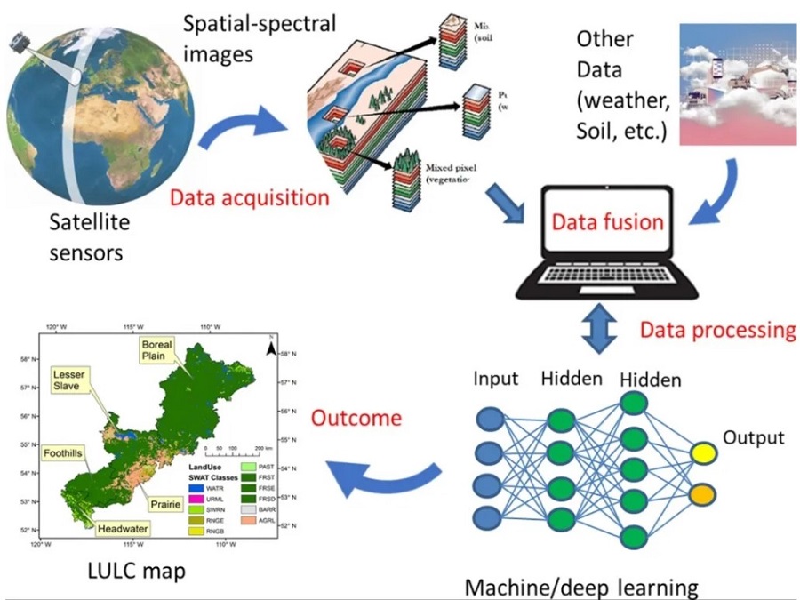
Remote Sensing The physical layer of the earth can be monitored by remote sensing. The satellite that orbits around the Earth captures the image of the Earth. New technology based on drones or unmanned aerial vehicles also aids in the collection of topographic pictures. These image sources can feed a large information about an area.… Continue reading Boosting Remote Sensing with Machine Learning

